
The integrated reporting provides understandable, comprehensible and immediately documented basics for decision making on many levels of responsibility. The system includes a summary risk assessment as a result of the performed calculations and modelings. It notably contains the assessment of probable person- and property damage in comparison to the costs of alternative safety solutions. For this, an appropriate reporting format is provided. The generated files resulting from the reporting module can be automatically converted into an HTML document, as a requirement for further handling in many other formats. Flexible reports
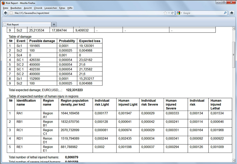
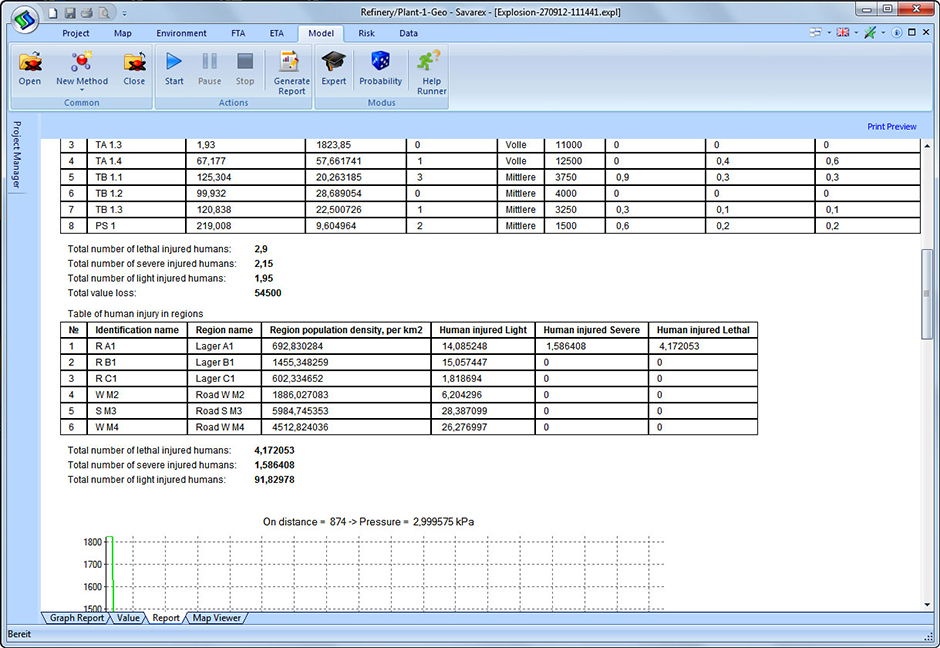
The illustration of the results of a safety and risk analysis is universally usable for project planning, investment decisions, land use plans, observations, permits and liability issues.